Hydraulic System Modeling Project, City of Los Angeles, Department of Water and Power (DWP)
CLIENT
Hydraulic System Modeling Project, City of Los Angeles, Department of Water and Power (LADWP)
SERVICES PROVIDED
Development of Planning Model; Service Zone Pilot Study Model; Electronic Facility Books; Water Quality Modeling; Demand Allocation Studies; Energy Analysis; Reservoir/Tank Water Quality Analysis; Graphic Information System (GIS)
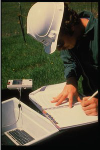
The Montgomery Watson/DRC Team developed hydraulic models for the LADWP’s Water Service Organization, coordinated through the Project Planning and Development Group. DWP chose the H2ONET software because it is user friendly, operates within AutoCAD, can exchange data with GIS, and has an open database structure. DRC staff assisted with developing the following hydraulic models:
- Planning Model of Entire City: This model included 16-inch and larger diameter pipelines, all groundwater wells, regulating stations, check valves, inter-city connection, Metropolitan Water District (MWD) pipelines and connections, pumping stations, hydrogeneration stations, tanks, reservoirs, and flow and pressure meters.
- Service Zone Pilot Study Model: This model was developed for areas with several pressure zones and all facilities within those pressure zones. Such facilities include distribution pipelines, source water connections to the area, regulating stations, check valves, pumping and hydro-generation stations, tanks, reservoirs, and flow and pressure meters.
The purpose of both is to develop detailed model creation standards and to evaluate the level of detail necessary for pressure zone models. The pilot study model evaluates the need for “all-pipe” models of pressure zones versus modeling only six-inch diameter and larger, from a hydraulic and a water quality perspective. Other goals of the pilot study model included developing an interfacing strategy with DWP’s GIS and other databases:
- Electronic Facility Books: This task helps convert information from paper to electronic format, integrate information from various databases and information systems, and implement tools to retrieve web-based data of all water system facilities information.
- Converting Water Service Maps to GIS Format: DRC is assisting this effort first in the Pilot Study area and potentially throughout the city. DWP’s long-term goal is to move all-electronic data manipulation from the Pipeline Location Reports through the as-builts.
- Water Quality Modeling: As part of the pilot study, this model calibrates water quality constituents and hydraulics, which may include what diameter of pipeline must be included in pressure zone models to model water quality accurately.
- Detailed Demand Allocation Studies: DRC is refining methodologies for allocating demands based on existing information and is helping to identify water duty factors and evaluating water use citywide.
- Converting Annual Flow Data Sheets to Electronic Format: Flow Data Sheets have been integrated into information available from the SCADA system. Operators can obtain flow data for any region, including peak hour, annual average, maximum week, and other data.
DRC helped prepare manuals that explain how the models were developed and recommend model maintenance procedures and helped develop standardized model reports to enhance the presentation of typical modeling results.
- Hydraulic grade line and project design plates for proposed storm drainage improvements;
- Preliminary design, including conceptual improvement plan and profile plates with starting and ending profile data for each of the 10 sites; and
- A conceptual level design project cost estimate (MCACES-MII) for a proposed solution for each site.
Based on field conditions, DRC determined the viability of designing a conceptual 25-year flood control storm drain plan. The determining factor is analyzing the capacity of the receiving disposal point based on the watershed evaluation of the drainage facilities. DRC reviewed the existing utility pipeline profiles to determine a practical bypass for the feasibility level, storm drainage system at each of the 10 sites. We performed conceptual-level hydraulics grade analyses to show that the downstream end of the project can receive the additional flow moving through the proposed storm drains to the terminus point. The project plans include information about the existing drainage facility and how it is being modified to remediate the local flooding at each site. The feasibility-level design plates included standard drawing from the “Green Book” Standard Plans. The final document also included a conceptual-level, project-quantity take-off and site-specific project cost for each site. Unique and innovative solutions under the constraints of the existing flow gradient and/or real estate limitations in an urbanized area to reduce flood risk to homes also were addressed. They included underground storage, park site detention, median detention, school ground detention, watershed planning, and others.
GALLERY