Citywide Storm Drainage Feasibility Alternative Analysis & Flood Improvement Master Plan within the City of La Mirada, California
CLIENT
U.S. Army Corps of Engineers Los Angeles District
SERVICES PROVIDED
Gather Information; Site Investigation; Coordination Meetings; Feasibility Level Design; Hydrology and Hydraulic Planning; Hydraulics Grade Analyses; Cost Estimates; Design Report; Drainage Capacity Study and Hydrology Analysis — Preliminary Engineering; Site Investigation; Coordination Meetings; Storm Drainage Study & Analysis; Hydraulic Calculation; Street and Pipe Flow Capacity
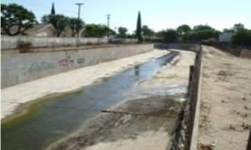
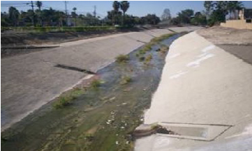
The City of La Mirada contracted the U.S. Army Corps of Engineers under a prime contract with D R Consultants to address flooding issues within the city in a two-phase project. DRC investigated and prepared a comprehensive engineering report for the city regarding storm water flooding. The study included hydrology data, survey data, and information from the County of Los Angeles and the city’s database for pipe systems and for hydraulic features of all study sites. Phase 1 – Citywide Hydrology Analysis and Storm Drainage Systems Capacity Evaluation Study: An investigation and preparation of an engineering feasibility and design documentation report that addressed the severe flooding and capacity of the storm drainage system within the highly urbanized community. The extent of flooding in the streets and adjacent areas, using the 10- and 25-year storms based upon the Los Angeles County Hydrology Manual, determined the flow in the streets and feasible solutions without going over the street curb or right-of-way to flood homes and obstruct traffic. La Mirada has at least 11 sites that severely flood, causing overflows that could produce major damage citywide if not addressed. Phase 2 – Feasibility Level Project Design and Cost Estimate for Storm Drainage Improvement at 10 Sites: Reviewed the Phase 1 report and, in discussions with the USACE and city, ten sites were selected for further study and for developing solutions. The conceptual-level design document for the 10 sites included:
- Hydraulic grade line and project design plates for proposed storm drainage improvements;
- Preliminary design, including conceptual improvement plan and profile plates with starting and ending profile data for each of the 10 sites; and
- A conceptual level design project cost estimate (MCACES-MII) for a proposed solution for each site.
Based on field conditions, DRC determined the viability of designing a conceptual 25-year flood control storm drain plan. The determining factor is analyzing the capacity of the receiving disposal point based on the watershed evaluation of the drainage facilities. DRC reviewed the existing utility pipeline profiles to determine a practical bypass for the feasibility level, storm drainage system at each of the 10 sites. We performed conceptual-level hydraulics grade analyses to show that the downstream end of the project can receive the additional flow moving through the proposed storm drains to the terminus point. The project plans include information about the existing drainage facility and how it is being modified to remediate the local flooding at each site. The feasibility-level design plates included standard drawing from the “Green Book” Standard Plans. The final document also included a conceptual-level, project-quantity take-off and site-specific project cost for each site. Unique and innovative solutions under the constraints of the existing flow gradient and/or real estate limitations in an urbanized area to reduce flood risk to homes also were addressed. They included underground storage, park site detention, median detention, school ground detention, watershed planning, and others.
GALLERY